



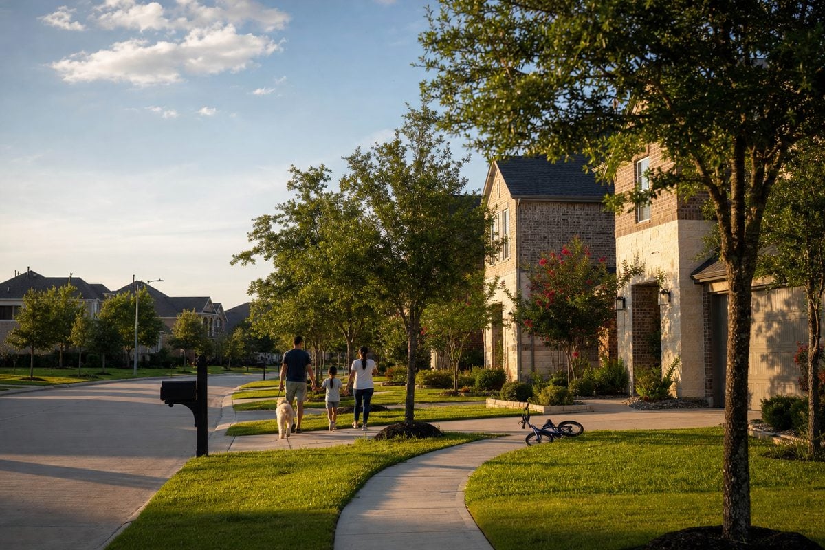
Katy vs Cypress is a closer call than most families expect, because the two suburbs are more alike than different: both are mostly master-planned, both lean on large school districts, and both carry a municipal utility district (MUD) tax in their newer sections. What separates them for a family is where you drive to work, which school district and county your specific address lands in, and how new a house you want. The rest of this post is the side-by-side, with every figure dated and sourced so you can check it.
Figures as of October 2026. Market medians are HAR’s October 2026 market-area updates, drive times are Google Maps typical times for a Tuesday in October 2026, school ratings are the Texas Education Agency’s 2026 accountability ratings, and tax rates are the 2025 and 2026 adopted rates on the appraisal-district records sampled for my Cypress and Katy guides. I refresh this post when HAR and TEA update.
If you want the long version of either place on its own, that lives in living in Cypress, TX and living in Katy, TX. This post is only about how they differ.
Katy vs Cypress at a glance
Here is the one-minute version. Every cell is a checkable fact, and the sections below explain each row.
| Question | Cypress | Katy |
|---|---|---|
| Commute corridors | US-290, the Grand Parkway (SH 99), and SH 249 toward Tomball on the northeast edge | I-10 (the Katy Freeway), the Grand Parkway, and the Westpark Tollway on the south side |
| Energy Corridor, 7:30 a.m. | 26 to 55 minutes from US-290 at Barker Cypress Road (15 to 20 miles) | 15 to 30 minutes depending on where in Katy you live; 20 to 35 minutes measured from I-10 at Pin Oak Road (12 miles) |
| Downtown Houston, 7:30 a.m. | 35 minutes to 1 hour 15 minutes (25 road miles) | 40 minutes to 1 hour 10 minutes (29 road miles) |
| County and city | Unincorporated Harris County; no city government and no city tax | A small city where Harris, Fort Bend, and Waller counties meet; most Katy-address homes are outside the city limits |
| School districts by address | About 82% Cy-Fair ISD; Tomball ISD on the north edge of 77429; Waller ISD in western Bridgeland and the Hockley-address communities | Mostly Katy ISD, with Cy-Fair ISD in 77449, Lamar CISD in 77494, Royal ISD in part of 77493 (including part of Sunterra), and slivers of Waller and Alief ISDs |
| Median sold price, HAR Oct. 2026 | Cypress North $444,000; Cypress South $502,000 | Katy–Southeast $484,000; Katy–Southwest $555,000 |
| Age of the typical home sold | Built 2003 in 77429; built 2022 in 77433 (median, 12 months to Oct. 2026) | Built 2025 in 77493, 2011 in 77494, 2004 in 77449, 1992 in 77450 |
| Combined property tax rate | $1.84 to $3.34 per $100 on the records sampled (2025); the water district is the difference | $1.95 to $3.04 per $100 inside the city (2026); outside it, a MUD and an emergency services district replace the city line |
| Flood profile | Cypress Creek and its tributaries; about 21% of 77429 and 29% of 77433 in the FEMA high-risk floodplain, the rest Zone X | Barker Reservoir watershed; inside the city limits, about 11% in the high-risk floodplain, another 11% shaded Zone X (a 0.2 percent annual chance), the rest Zone X |
| Feel | Lakes, trails, and larger lots along 290; more open land still being built | Denser retail and dining along I-10; a small historic downtown; west side still building |
Both suburbs are large. Cypress’s two ZIP codes held about 213,000 residents in the Census Bureau’s 2020–2024 American Community Survey; Katy’s four ZIP codes held about 414,000, of whom only about 28,000 live inside the City of Katy itself. Neither is a single market, which is why the price and age rows above carry more than one figure.
Commute: who each suburb works for
This is the first question I ask a family weighing Katy vs Cypress, because it usually settles the matter before schools or taxes do. The two suburbs sit on different freeways, and a daily drive against the wrong one wears a family down.
Katy is the I-10 side. The Katy Freeway runs straight into the Energy Corridor, and that is the commute Katy was built around. For Katy as a whole, figure 15 to 30 minutes to the Energy Corridor depending on where in Katy you live; measured from I-10 at Pin Oak Road, the interchange nearest Old Towne Katy, Google Maps showed 20 to 35 minutes at 7:30 a.m. and 14 to 18 at 11 a.m. in October 2026. Downtown from that same interchange is 29 road miles: 40 minutes to 1 hour 10 minutes at 7:30 a.m., 28 to 40 minutes at 11. The Texas Medical Center runs 45 minutes to 1 hour 20 minutes in the morning. The airports are the weak spot: Bush Intercontinental is 55 minutes to 1 hour 30 minutes at 7:30 a.m., and Hobby 1 hour to 1 hour 50 minutes.
Cypress is the US-290 side. Highway 290 and the Grand Parkway carry most of it, with SH 249 serving the northeast edge toward Tomball. Measured from US-290 at Barker Cypress Road, the Energy Corridor is 15 to 20 miles and 26 to 55 minutes at 7:30 a.m. (22 to 30 at 11 a.m.), so a Cypress family with an Energy Corridor job is trading time for a lower price in the established sections. Downtown is 25 road miles: 35 minutes to 1 hour 15 minutes at 7:30 a.m., 24 to 35 minutes at midday. The Medical Center runs 50 minutes to 1 hour 40 minutes in the morning. Cypress does better on the north-side airport: Bush Intercontinental is 35 minutes to 1 hour 10 minutes at 7:30 a.m., about 20 minutes less than from Katy.
Both suburbs have a METRO Park & Ride on their main freeway (Cypress on the 290 frontage road at Barker Cypress, Katy at the Grand Parkway and I-10), which turns a downtown commute into a bus ride for the families who can use it. And the Grand Parkway connects the two: it meets US-290 in western Cypress (10 to 14 minutes from Barker Cypress) and runs south to I-10, which is why some of my clients end up in Bridgeland or Towne Lake with a west-side job after all. The full drive-time tables, with midday times and the Galleria, are on my Cypress guide and Katy guide; test-drive your own route at your own hour before you decide.
Schools: it’s the address, not the suburb
People compare Katy vs Cypress as if each were one school district, and neither one is. The district follows the parcel, and the same community can straddle a district line, so the question is always which district a specific address is zoned to. Here is the map for each, with the Texas Education Agency’s 2026 accountability ratings stated as facts.
- Cypress. About 82% of the area is Cypress-Fairbanks ISD, rated “B” (86) for 2026, with twelve comprehensive high schools; Bridgeland High (“A”, 93), Cypress Ranch (“A”, 94), and Cypress Woods (“A”, 92) serve many of the master-planned communities. The exceptions sit at the edges: Tomball ISD, rated “A” (92), covers the north edge of 77429 around Northpointe, Oakcrest North, Hayden Lakes, and Indian Trails; Waller ISD, rated “B” (80), serves most of Bridgeland’s Prairieland and Creekland villages and the Hockley-address communities such as Dellrose and Cypress Green; and a small, mostly undeveloped Katy ISD corner sits in southwest 77433.
- Katy. Most of the four Katy ZIP codes are Katy ISD, rated “B” (88) for 2026, but a Katy address can be zoned to any of six districts. Cy-Fair ISD, “B” (86), covers about 44% of 77449. Lamar CISD, “B” (87), covers about 8% of 77494, including most of Tamarron and Firethorne West. Royal ISD, rated “D” (64), covers about 10% of 77493, including part of Sunterra, so two Sunterra homes a few streets apart can be in different districts. Waller ISD reaches about 4% of 77493, and a sliver of Alief ISD sits in 77450.
The check takes five minutes and I do it on every home a client is serious about: pull the parcel on the county appraisal district’s site (HCAD for Harris County, FBCAD for Fort Bend, the Waller County Appraisal District for the Waller side of 77493), where the school district appears in the list of taxing units, then look up the campuses on that district’s attendance-zone tool, and verify the rating at TXschools.gov. Districts rezone as campuses open (Tomball West High opened in August 2026 with two grades; Lamar CISD’s new Williams High takes part of Young Ranch in 2027), so neither a listing’s school line nor a community’s name is the final word. If a particular campus is the reason you’re moving, we shop by campus zone.
Taxes and services: unincorporated Cypress vs. the City of Katy and everything around it
This is the comparison most Katy vs Cypress articles leave out, and it changes the monthly payment more than anything in the listing photos. Start with the geography, because it drives the bill.
Cypress is not a city. It is an unincorporated area of northwest Harris County, two ZIP codes with no city hall and no city tax line. Water, sewer, and drainage come from the subdivision’s municipal utility district (MUD) or water control and improvement district, and fire and EMS come from an emergency services district. The 2025 bill for a Cy-Fair ISD address begins at the same base of $1.801828 per $100 (the school district, Lone Star College, and five county units), the emergency services district adds $0.038831 to $0.20, and the water district adds anywhere from nothing to about $1.50. On the records sampled for my Cypress guide, combined 2025 rates ran from $1.840659 per $100 in a no-water-district section to $3.340659 in the newest MUD sections, which is roughly $7,400 versus $13,400 a year on a $400,000 home before exemptions.
Katy is really two places. The City of Katy is a small incorporated city (about 15 square miles) where Harris, Fort Bend, and Waller counties come together, and only 8,886 of the 134,239 recorded lots in the four Katy ZIP codes sit inside it. Inside the city you pay the City of Katy’s $0.42 per $100 (2026) and get city water, sewer, trash, police, and fire for it; the older in-city neighborhoods have no MUD at all, so their 2026 combined rates run $1.954100 on the Fort Bend side to $2.213368 on the Harris side. The newer in-city communities such as Cane Island add a MUD on top of the city line and reach $3.037357. Outside the city limits, which is where Cinco Ranch, Firethorne, and nearly every other large Katy community sit, there is no city tax; a Harris County address pays a MUD plus an emergency services district, and the communities on the Fort Bend and Waller County sides have MUDs of their own.
So the tax comparison that matters is between a young MUD and one whose bonds are mostly paid off, and both suburbs have both. A utility district that financed its water and sewer in 2022 is still paying down young bonds and bills a high rate; one that built out in 1998 has paid down most of its debt. Cypress’s established sections (Coles Crossing at $2.180659, Fairfield at $2.214159, Longwood Village at $2.234906, Westgate at $2.320659, all 2025) sit well below its newest sections (Bridgeland’s Parkland village at $3.165659, Dunham Pointe at $3.190659), and the Katy in-city figures in the paragraph above tell the same story. Priced on one house, as I worked it in my first-time home buyer’s guide to Cypress: a $340,000 home at a 2.4% combined rate carries about $8,160 a year in property tax, and the same price at 3.3% carries about $11,220. The difference is roughly $255 every month, and it is already in the payment before the two houses have been compared on anything else. What a MUD is and how its rate falls over time is in what is a MUD district; the full 2025 and 2026 rate tables for both suburbs are on the two city guides. File your homestead exemption as soon as you close (the $140,000 school exemption applies from the 2025 tax year); it lowers the school and county lines but not the MUD line, so the gap shrinks rather than disappears. Rates are the adopted rates on the parcel records sampled; check the specific parcel’s own record with HCAD, FBCAD, or the Waller County Appraisal District before relying on any of them. This is general information, not tax advice.
Housing and price: what the same budget buys
HAR tracks each suburb as two market areas, and as of October 2026 the medians were: Cypress North (the Fairfield and Coles Crossing side of 290) $444,000 with 4.5 months of inventory and about 42 days on market; Cypress South (Bridgeland, Towne Lake, Dunham Pointe) $502,000 with 4.9 months and about 55 days; Katy–Southeast $484,000 with 3.8 months and about 34 days; and Katy–Southwest (the Cinco Ranch and Seven Lakes side) $555,000 with 4.7 months and about 40 days. Both Cypress areas and Katy–Southwest were balanced; Katy–Southeast had tipped slightly toward sellers. HAR’s market areas and the ZIP-code lines don’t match up, and the city-wide “Katy” and “Cypress” numbers on the portals come in lower because a mailing address takes in far more ground than those areas do.
The medians hide the more useful fact, which is the age of what you’re buying. The typical home sold over the past twelve months was built in 2022 in Cypress’s 77433 and in 2025 in Katy’s 77493; it was built in 2003 in Cypress’s 77429 and in 1992 in Katy’s 77450. In other words, each suburb has a new side and an established side, and a family’s budget usually buys one of these:
- A new build on the growing edge. West and northwest Katy (77493) in communities such as Sunterra, Elyson, and Tamarron, or Cypress’s 77433 in Bridgeland and Dunham Pointe. Newer house, smaller lot, the highest combined tax rate, and the builder’s incentive package, which on an inventory home is most often a lower rate through the builder’s preferred lender; a cash credit is the less common form. How to weigh that against a resale seller’s concession is in new construction vs. resale in Houston.
- A 2010s master-planned resale. The middle of Cinco Ranch and the established villages of Bridgeland, Towne Lake, and Firethorne. Amenities already built, MUD rates partway down, the widest choice of floor plans.
- A 1990s or 2000s home on a mature lot. Fairfield, Coles Crossing, and Longwood Village in Cypress; Kelliwood, Grand Lakes, and Seven Meadows in Katy. Bigger trees, bigger lots, the lowest tax rates, and a renovation budget somewhere in the plan.
Because I’m also a Texas Certified Residential Appraiser, what I watch for a family is which section holds its value: the established communities in both places have had steady resale demand, while a brand-new section competes with the builder’s next phase for a few years. To see what a specific budget actually buys this month, my roundups are current: what $400K buys in Cypress, what $350K buys in Katy, $400K to $450K in Cypress, and $400K to $450K in Katy. And if you already own in one suburb and are moving to the other, the sale side has its own local questions; for Katy they’re in selling your home in Katy, TX.
Flood: the calm comparison
Both suburbs are flat Gulf Coast prairie, both have had homes flood in past storms, and in both the answer changes street by street. The useful difference is which water each one sits near.
Katy sits in the Barker Reservoir watershed. Almost all of the City of Katy drains toward Barker, one of the two federal flood-control reservoirs east of Katy. Hurricane Harvey in 2017 is the storm Katy buyers ask about, and the answer is that its effects were uneven: some homes near the reservoirs flooded for the first time, and large parts of the Katy area stayed dry, so the history is a street-level question. Draining toward the reservoir is also different from sitting in it; the Barker dam is about 9 miles from the nearest city limit. Inside the city limits, about 11% of the land lies in the FEMA high-risk floodplain (Zone A, AE, or the floodway, mostly along Cane Island Branch, Willow Fork, and Buffalo Bayou tributaries), another 11% is shaded Zone X (a 0.2 percent annual chance), and the rest is Zone X, FEMA’s minimal-risk area. Those shares are for the city itself, not the four Katy ZIP codes.
Cypress sits on Cypress Creek and its tributaries. The high-risk floodplain runs along Cypress, Little Cypress, Langham, and Bear creeks, and takes in about 21% of 77429 and 29% of 77433; the rest is Zone X. Roughly half of 77433 drains toward Addicks Reservoir by way of Langham and Bear creeks, but the ZIP’s nearest edge sits about 3 miles from the reservoir’s government land, and no part of Cypress drains to Barker.
What I do on every home in either suburb is the same: pull the FEMA zone for the exact lot on the FEMA Map Service Center, check the Harris County Flood Control District maps for the watershed and any reservoir flood-pool line, read the seller’s flooding answers and the reservoir flood-pool questions on the Texas seller’s disclosure notice, and price flood insurance before the option period ends, because a Zone X home can still flood and insurance there is optional but available. The disclosure questions and the maps behind them are walked through in Houston’s flood disclosure questions, mapped.
Cypress vs. Katy: which one fits which family
With the facts on the table, here is how Cypress vs Katy usually resolves for the families I work with. There is no winner, only a better fit.
- Both parents in the Energy Corridor, or one downtown. That family usually lands in Katy. The I-10 drive to the Energy Corridor runs 15 to 30 minutes depending on where in Katy you live, and Park & Ride covers downtown. Start with Cinco Ranch for the established middle, Firethorne for a built-out master plan on the Fulshear side, and Ventana Lakes for a Katy ISD resale whose MUD rate has dropped each year since 2016.
- A job along 290, 249, or in the north and northwest employment centers. That points to Cypress. Look at Coles Crossing and Fairfield north of 290, or Towne Lake if the lake is the point.
- You want a brand-new house with a lagoon or a lake. Either suburb can do this. Sunterra in Katy is built around a Crystal Lagoon with 18 builders selling; Bridgeland and Dunham Pointe carry most of Cypress’s active new construction. Compare the two tax stacks and the school zoning for the specific section, because both vary inside the community.
- You want a mature lot, big trees, and a paid-down MUD. Either suburb, on its established side: Longwood Village and Fairfield in Cypress; Kelliwood, Grand Lakes, and Seven Meadows in Katy.
- You want to live inside an actual city, with city water, trash, police, and fire. Only Katy offers this, and only inside the city limits: Cane Island for new-ish construction or Old Towne Katy for a historic street. Cypress has no city to move into.
The map of every Cypress community and every Katy community, with a guide for each, is on my Houston neighborhoods hub.
How I help families choose: Katy vs Cypress on one first call
When a family calls me with this question, I start with four questions before we look at a single house: where each adult drives on a weekday, whether a specific school or district is the reason for the move, what monthly payment you want to live with (usually less than what you qualify for), and whether a new build or a settled street matters more to you. Those answers usually point at one suburb and two or three communities, and we tour both suburbs in one day so you feel the drive and see the streets for yourself.
On every home you’re serious about, I run the same address-level checks before you write an offer: the school district and campus zone from the appraisal-district record, the county and the combined tax rate with the MUD line itemized, the FEMA zone and flood history, and whether the address is inside a city. None of those show up reliably on a listing site, and they are the differences that actually decide between the two suburbs. Representation and how it’s paid are set out in a written buyer representation agreement before we tour; Texas requires that, and it’s where you learn what I cost before you’ve committed to anything. The full home-buying process is on my buying page.
Whoever you work with, a real estate agent who works both suburbs should be able to answer these on the spot: which school district a specific street in Sunterra or western Bridgeland is zoned to, what the MUD line is on the tax bill of the house you just toured, and whether that house is inside the City of Katy. If the answers are vague, keep interviewing. My full checklist is in how to choose a REALTOR® in Houston.
Katy vs Cypress: questions families ask me
Is Katy or Cypress better for families?
Neither is better across the board. Both are mostly master-planned suburbs with pools, trails, and large school districts, and both carry MUD taxes in their newer sections. Katy fits a family commuting to the Energy Corridor on I-10 and a family that wants to live inside a city; Cypress fits a family working along US-290 or SH 249 and a family that wants a larger lot in an established section. The school district and the tax rate are decided by the specific address in either suburb, so the useful comparison is between two specific addresses.
Which is closer to the Energy Corridor, Katy or Cypress?
Katy. The Energy Corridor is 15 to 30 minutes away on I-10 depending on where in Katy you live; measured from I-10 at Pin Oak Road it was 20 to 35 minutes at 7:30 a.m. in October 2026. From US-290 at Barker Cypress Road in Cypress, the same trip was 26 to 55 minutes at 7:30 a.m. and 22 to 30 minutes at midday.
Does Katy or Cypress have better schools?
The district your specific address is zoned to decides it, and both suburbs contain several. The Texas Education Agency rated Katy ISD B (88), Cypress-Fairbanks ISD B (86), Tomball ISD A (92), Lamar CISD B (87), Waller ISD B (80), and Royal ISD D (64) for 2026. Confirm the district on the county appraisal record for the specific parcel, then the campus on the district’s attendance-zone map, then the rating on TXschools.gov.
Is Cypress in the City of Houston?
No. Cypress is unincorporated northwest Harris County, defined by ZIP codes 77429 and 77433. There is no City of Cypress and no city property tax, so the utility district, not a city, is the line you’ll see on the tax bill, and fire and EMS come through an emergency services district.
Are Katy homes inside the City of Katy?
Most are not. The City of Katy is about 15 square miles where Harris, Fort Bend, and Waller counties meet, and only 8,886 of the 134,239 recorded lots in the four Katy ZIP codes are inside it. Cinco Ranch, Firethorne, Grand Lakes, and nearly every other large Katy community sit outside the city limits on unincorporated county land; Cane Island and Old Towne Katy are inside. The city publishes a resident-lookup map, and City of Katy appears as a taxing unit on an in-city parcel record.
Which is more affordable right now, Katy or Cypress?
By HAR’s October 2026 market-area medians, Cypress North ($444,000) was the lowest of the four areas and Katy–Southwest ($555,000) the highest, with Katy–Southeast ($484,000) and Cypress South ($502,000) in between. In the Katy vs Cypress price comparison, my own read is that the lower-priced area in each suburb is its older side, and the older side also carries the lower tax rate, so the monthly payment gap runs wider than the price gap. Those figures move monthly; call me for the current ones.
Want to see both in one day?
Tell me where you drive and what matters to your family, and I’ll put together a Katy and Cypress tour with the school, tax, and flood checks done on every home before we go. There’s no pressure and no obligation.
Schedule a Consultation
Call or Text (281) 500-7077
Kevan Pewitt · REALTOR® & Broker · Houston Prime Realty
Last updated: October 2026 · Sources: HAR market-area updates (October 2026); Google Maps typical drive times (Tuesday, October 2026); Texas Education Agency 2026 accountability ratings via TXschools.gov; Harris Central Appraisal District, Fort Bend Central Appraisal District, and Waller County Appraisal District parcel records (2025 and 2026 adopted rates); FEMA National Flood Hazard Layer; City of Katy; U.S. Census Bureau 2020–2024 American Community Survey. Figures are point-in-time and refreshed when HAR and TEA update. General information, not legal or tax advice.
More on this topic: Houston neighborhoods & community →
